The El Reno Survey Project
Crowd-sourcing storm chasers for data on the world’s largest documented tornado
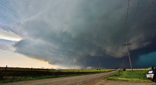
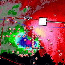
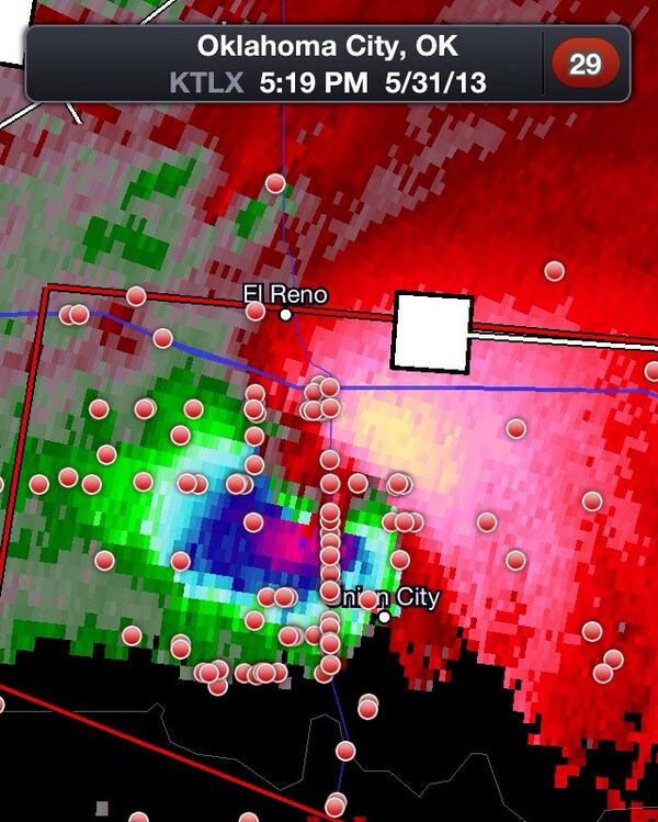
Our project, the El Reno Survey, aims to create a new structure for the public at large to provide critically needed data resources to the research community for comprehensive analysis of major tornadoes and their impacts. Our test case is the superlative tornadic thunderstorm at El Reno, Oklahoma on 31 May 2013, featured as the cover story of National Geographic Magazine in November 2013[1]. The El Reno Storm produced the largest tornado ever documented (2.6 mile diameter), with wind speeds measured by radar reaching to 300 mph, among the highest ever recorded. Tragically, however, the storm’s uncommon behavior and dimensions led to the first known storm chaser fatalities, documented in the National Geographic article and other media. The storm is currently the subject of research investigations by academic groups and US government scientists. It was sampled with advanced radar technologies at ultra-high spatial and temporal resolution[2], as well as Doppler radars operated by the National Severe Storms Laboratory and NOAA. Two remote-sensing networks mapped its lightning activity while the National Weather Service also documented the tornado track and resulting damage in detail.
Also remarkable from a research standpoint is that the El Reno Storm was likely the best-documented tornado to date in terms of its visual characteristics. By investigating through the storm chasing community online, we estimate that 300 or more chase groups observed the storm, most documenting it in high-resolution still and video imagery. While some selected imagery has been placed on the Internet by individual chasers, an immense database of visual material remains dispersed globally in individual archives, with no coordination or centralization. Recognizing this unutilized potential, our project team recently began a first-ever effort to consolidate visual material collected by storm chasers into a database to serve the research community. Success in this enterprise might encourage reproduction of such crowd-sourcing approaches for future storm events of interest to researchers.
To make the visual information useful to the scientific community, it is imperative to determine the space and time coordinates of all imagery that we are able to procure. To do this, all video and still images submitted are temporally synchronized by correcting time records on digital files using lightning flash frequency characteristics, while Google EarthTM and GPS records of chasers are applied to establish the capture locations of all imagery. Our growing database is a library of video and still images, all fixed accurately in time and location, that can be mined by researchers for imagery of particular phenomena, sectors of the storm, or to create 3-dimensional mapping of features such as sub-vortices of the major tornado, for any specified time or location of interest.